¶ Navigation
Navigation is the art of finding where you are, where something else is, and moving between points quickly, efficiently, and without getting lost.
¶ Basics of Map Reading
Before you can find yourself on a map, first you must learn to read one in the first place. The first thing to learn is what an azimuth is.
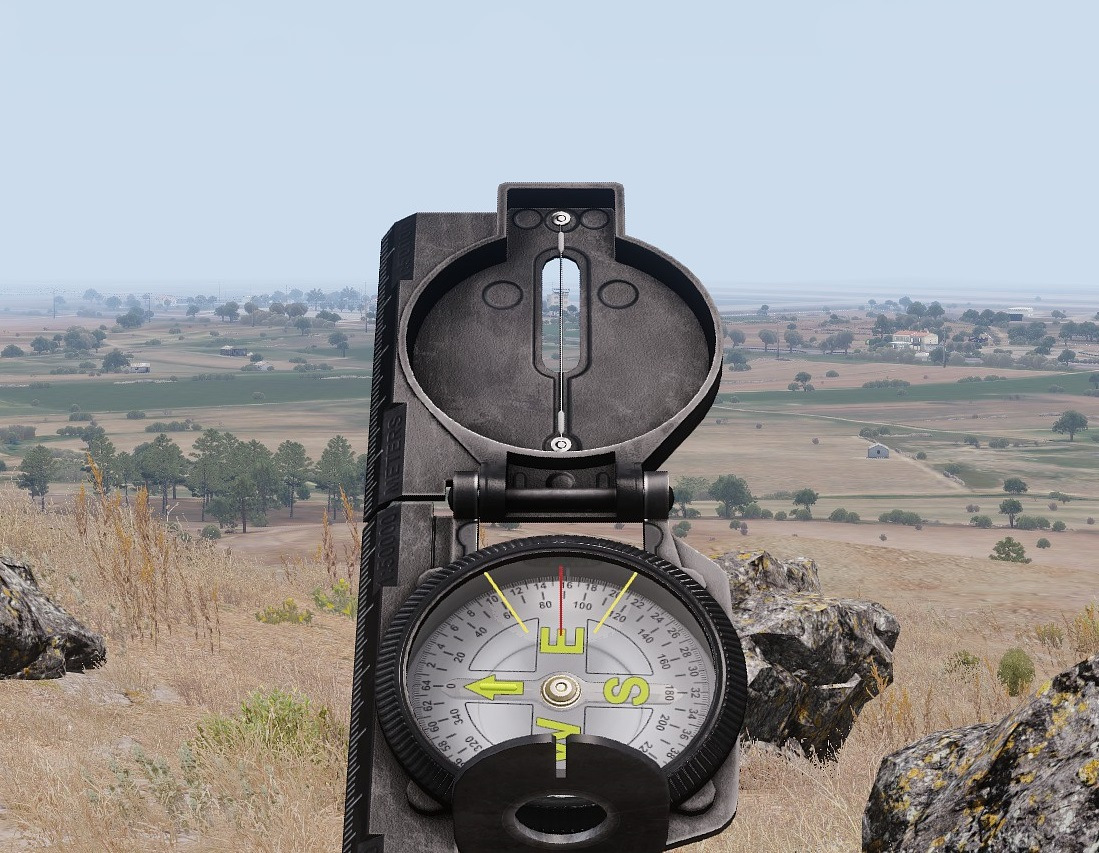
Compass
In this image, you can see that the wire running down the center of our compass is focused on a building. Looking down, we see that the red line on our compass is just before the tick that indicates ninety degrees, approximately at eighty nine degrees. This is our direction, or azimuth, to the building.
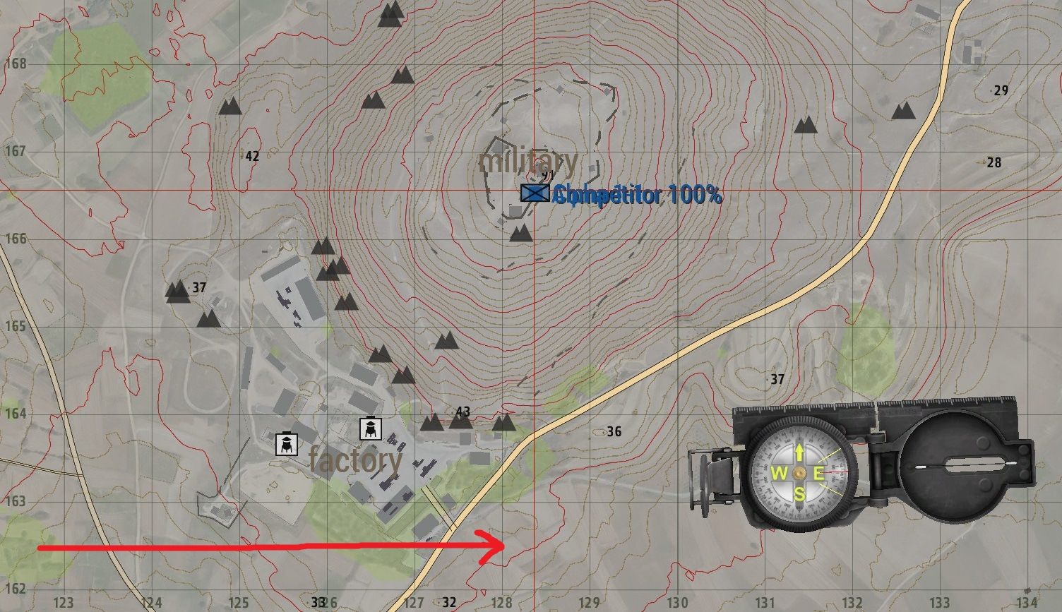
Right
Next, is learning how we identify locations on a map. For this we use a system known as grid squares. Every map is split into squares, first of tens of kilometers, then single kilometers, and then hundreds of meters. We can further divide them ourselves into tens of meters, or even single meters for very precise readings. The reading itself is called a grid reference, or grid ref, and is always given in four, six, eight, or ten digit format. To determine a location’s grid reference, remember to go RIGHT, then UP as demonstrated below.
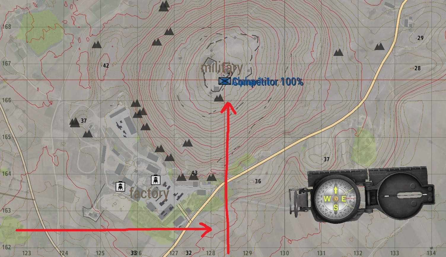
Up
As you can see, we go RIGHT to line 128, and everything to the right of it until it hits the next line is in longitudinal line 128. Then we go UP to line 166. Everything above this line until it hits the next line is in lateral line 166. Combining them, remembering to put RIGHT first then UP, we get a grid reference of 128166. This gives us a location within 100 meters.
¶ Map Tools
To get more precise, we’ll need a set of map tools, which are added to the game via ACE. They are not automatically added, so you’ll need to pick them up from the arsenal to use them, or bug your mission makers to include them in your standard kits. To raise your map tools, first open your map, then ACE interact with yourself. Select map tools, and show small map tool. It will appear in the lower left corner of your map. Drag it to where you are working, and we can use it to get an even more precise measurement.
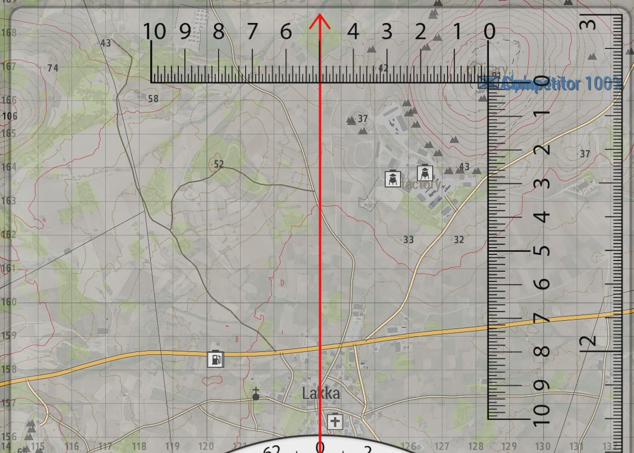
Map Tools
The intersecting lines here are used for getting precise measurements. To use them, first put the intersection of the zeroes over your point as shown.
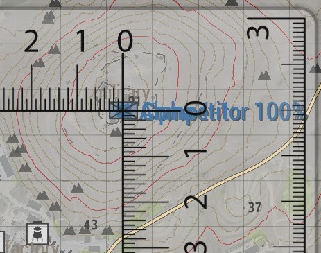
We get our readings by seeing where the measurement tool intersects the grid square, once again going RIGHT and then UP. We round to the nearest line. In this case, going right, we are nearest the fourth tick, giving us a measurement of 1284. Then we go up, and we are nearest fifth tick, giving us a measurement of 1665. We can combine these into an eight digit grid reference, 12841665. This is accurate within ten meters. Note that grid references should be read in military fashion, speaking each number. I.e. One Two Eight Four One Six Seven Five, not twelve eighty four, sixteen seventy five.
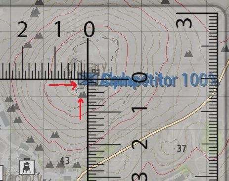
Right and up
You can get an even more accurate reading by estimating where the point would fall between the smaller tick marks to create a ten digit grid reference, but such accuracy is rarely necessary.
Finally, by holding CTRL and drawing along the edge of your map tool, you can draw a perfectly straight line. This will come in handy soon.
¶ Unknown Points
We now know how to describe a point on the map using a grid reference, but how do we plot the location of something we can see, but do not have a marker for? We have several options. The first, and easiest is terrain association, the second is intersection, and the final method is resection. All three have their uses, and which should be used will change from situation to situation.
¶ Terrain Association
Terrain association is the art of finding the location of something that is not on a map by comparing it to things that are. This may be very simple. For example, if a vehicle is parked at an intersection of two roads that are on a map, you know exactly where to mark it. It can also be much more complicated. It may be along a ridgeline that you can see, and to the west of one building, but to the east of another. This gives you an area that it is in, and your mark may be less accurate. The upside to terrain association is that it comes naturally for most people, and it only requires a map and compass. The downside is that in most cases it is fairly inaccurate.
¶ Intersection
Intersection is a technique which uses two observers with known locations who can communicate azimuths to a target to determine the targets exact location. Each observer gets an azimuth to their targets and plots a straight line from their location towards the target. Since we know where our observers are, the target must be exactly where the lines intersect!
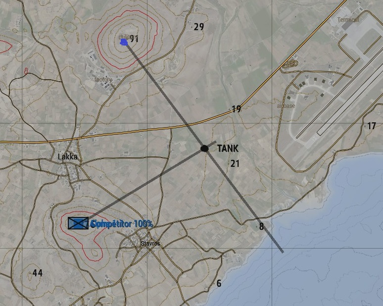
Intersection
There is a method for intersection that requires only one observer, but it requires that the target be on or near some sort of lateral backstop such as a road, coastline, cliff face, or forest edge. Using this method, a single observer whose location obtains an azimuth to the target and plots a line to the target. Since there can be only one place where that line intersects the road (or whatever you are using), we now have a precise location to the target.
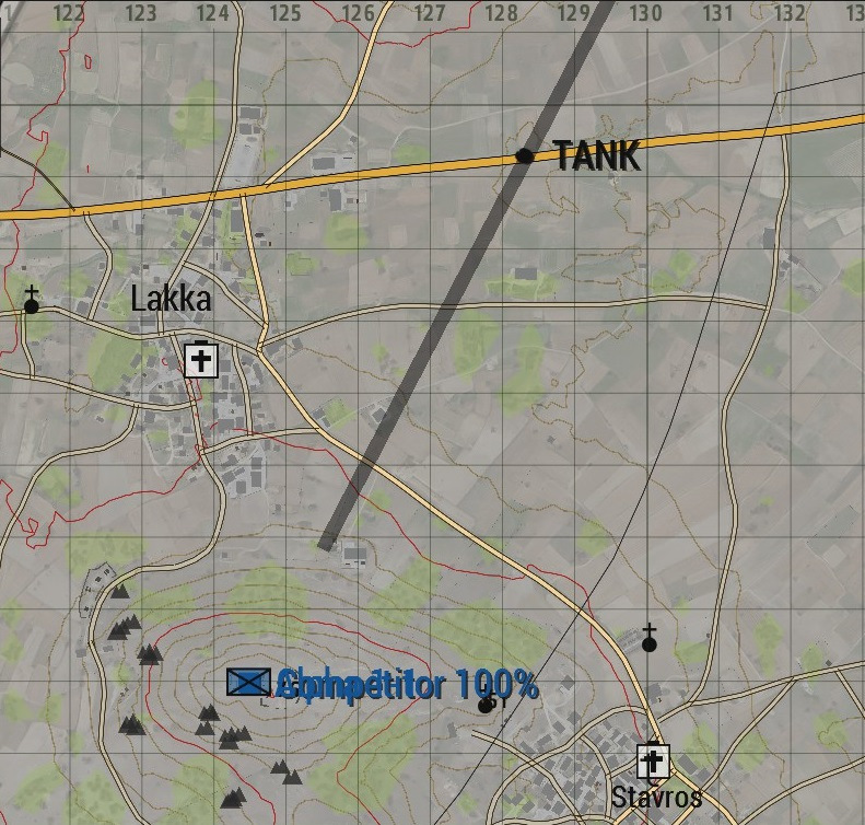
Intersection with road
¶ Resection
Resection is the final technique, and it is used to find an observer’s location when they are unsure of where they are. To do this, the observer must have a rough idea of where they are, and find two visible landmarks. The observer then gets an azimuth to each landmarks, and plots a line from the landmark, back towards themselves. Since there is only one spot where the two intersect, the observer now knows precisely where they are at.
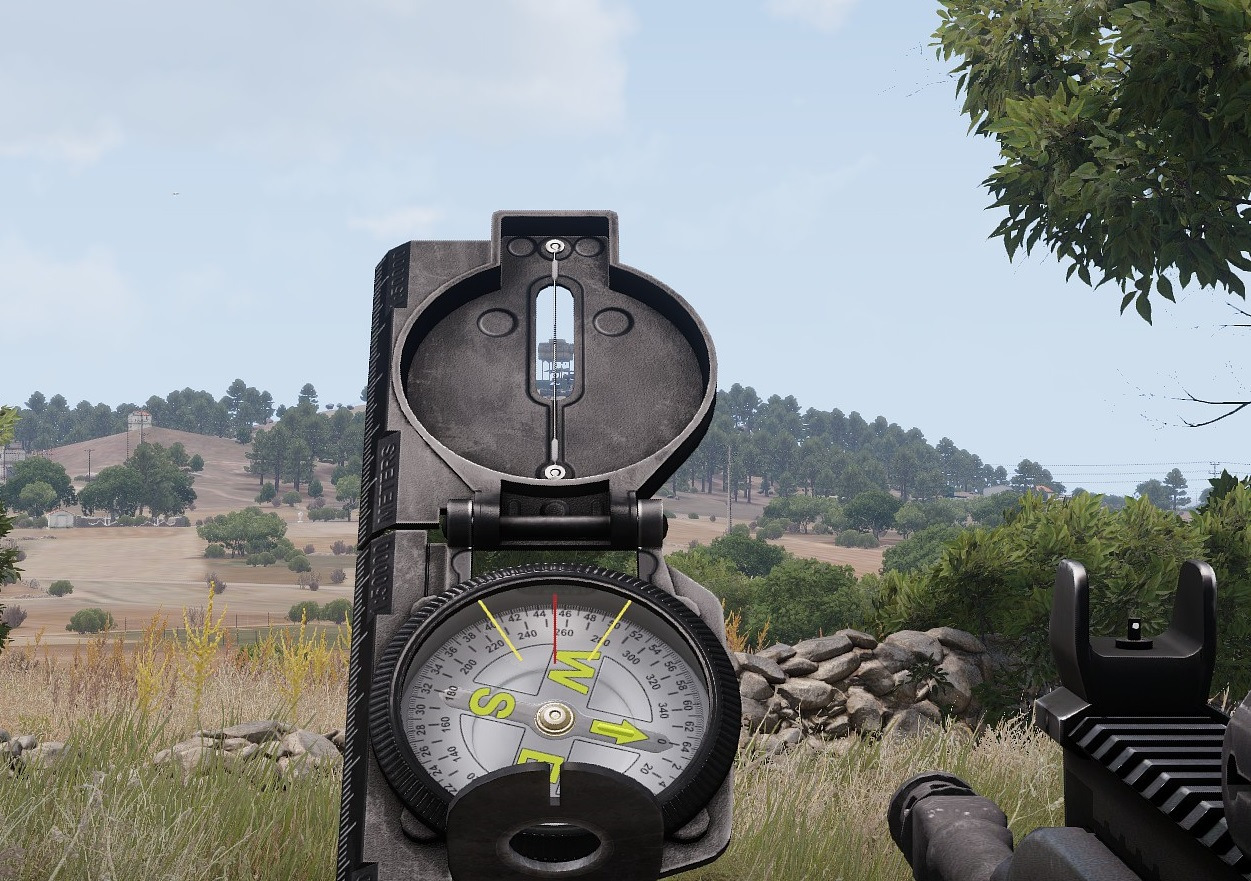
resection of first pont
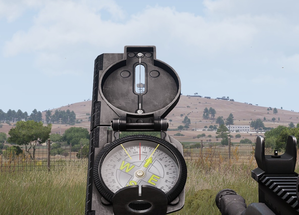
resection of second pont
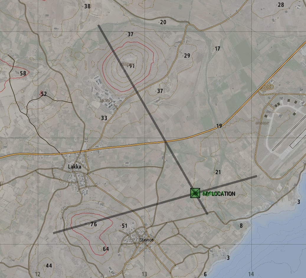
X marks the spot